Self-Developed and Upgraded, Newly Released | D-OP5000 Tilt Photography Module
D-OP5000 is a five-lens tilt photography module with a 126-megapixel APS-C format independently developed by Foxtech Robot. Compared with the previous generation product, the performance of D-OP5000 has been fully upgraded, with more outstanding imaging quality, more efficient and faster internal and external processing efficiency, and combined with the Foxtech Robot intelligent flight platform, the oblique photography application experience has been fully upgraded.
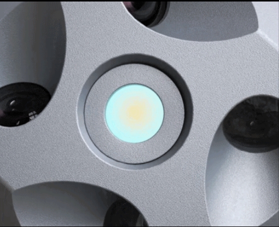
D-OP5000 uses a self-developed movement with APS-C format, with a single lens resolution of approximately 26 million pixels and a total resolution of up to 126 million pixels. It supports user-adjustable ISO and white balance modes, allowing for high-quality aerial photography in complex environments. image.
Customized Lens, Small Size, High Precision
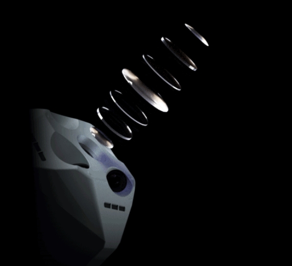
D-OP5000 uses a customized high-performance surveying lens. The optical design adopts double Gaussian symmetry structure and abnormal dispersion lenses, which can effectively control the load volume and suppress the aberration of the optical system. After testing and calculation, the overall volume of the load is reduced by about 67% compared with the previous generation product, and the optical distortion of the lens is within 2‰.
Lens Focal Length-Respond to New Demands for Real-Life 3D
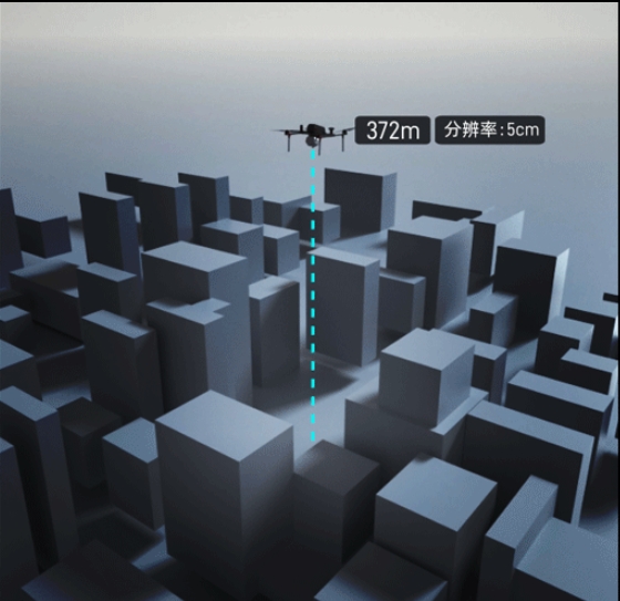
D-OP5000 is fully optimized in hardware in response to the three-dimensional construction of urban real scenes. Through a large number of simulation experiments and market research, Foxtech Robot engineers finally came to the conclusion that 28mm (downward view)/40mm (tilt) is the focal length of D-OP5000. Under the requirement of 3 cm image resolution, the operating altitude is 223 meters; with 5 cm image resolution, the operating altitude is 372 meters, which meets the safety and data collection needs of three-dimensional operations in urban scenes.
Mechanical Global Shutter Accurately Reproduces the Scene in the Measurement Area
The D-OP5000 uses a mechanical global shutter that can effectively avoid the jelly effect caused by exposure delays; the shutter speed can reach up to 1/2000 seconds, which can reduce image movement caused by too fast movement of the drone. Through the above methods, D-OP5000 can greatly reduce image errors and accurately reproduce the scene in the measurement area.
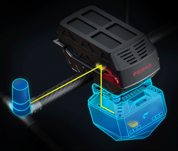
Real-time POS Stamping, Simplified Post-Processing Steps
D-OP5000 can obtain high-precision position information at the moment of taking pictures in real time based on network RTK, and further automatically corrects the eccentricity to the center of each lens, allowing high-precision position information to be directly written into the image. There is no need for POS calculation steps in post-processing, making the operation simpler and more efficient.
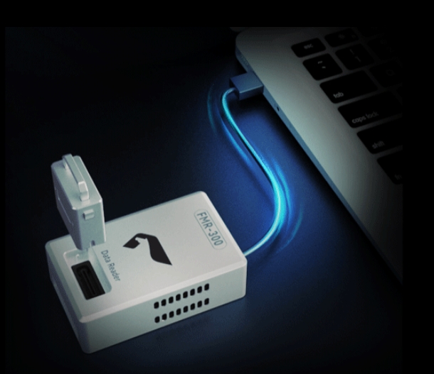
Centralized Storage Modules Improve Internal and External Processing Efficiency
D-OP5000 adopts centralized storage mode, with a standard 640GB large-capacity storage module and a transmission speed of up to 300MB/S. The ImageCopyTool tool used with Foxtech Robot UAV Manager can realize camera information viewing, multi-sort data merging, rapid data renaming, custom coordinate system modification, redundant image removal based on the survey area, one-click automatic data copy and automatic generation Internal engineering documents (housekeeper/view/CC), etc., greatly improve the efficiency of field copying and internal processing.
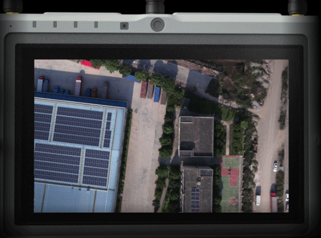
Five-Lens Picture Transmission Wheel Display, Comprehensive Understanding of the Measurement Area Information
D-OP5000 supports multi-lens image transmission wheel display. When D-OP5000 is mounted on D20 or D500, the HGS2000 handheld ground station can be used to alternately switch real-time image transmission from different perspectives for ease of viewing. Get comprehensive information about the survey area.
Model Case Display
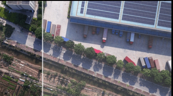
D-OP5000 can be mounted on a variety of Foxtech Robot intelligent flight platforms such as D20, D500 and D2000/D2000S, and can meet the needs of data collection and high-precision model production in various scenarios such as mines, factories, rural areas, cities, and mountainous areas with large height differences.
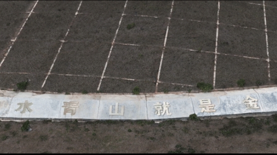
This test uses D2000 equipped with D-OP5000 to acquire data from Wujiazhai Reservoir in Yuanyang County, Honghe River, Yunnan Province, and simultaneously uses RTK to collect ground points for accuracy verification. This field operation lasted about 30 minutes, and more than 6,000 1.5cm reservoir images were acquired. They were copied to the local area using the ImageCopyTool tool and generated engineering files. The collected ground points were input for accuracy verification. It can be seen from the results that the overall effect of the reservoir model is clear, the error in the model level is about 1cm, and the error in the elevation is about 0.8cm, which is in line with the accuracy of image-free control. To sum up, D-OP5000 is an industry-leading tool for high-performance tilt photography.